
Cusop History Group
Maps of Cusop
CUSOP MAPS - available for loan through Cusop History Group
Scale 1:2500 County Series
-
Herefordshire Sheet XXX1.9 Brecknockshire XV111.9 2nd Edition 1904 Surveyed 1886 Revised 1903. Relevant topographic coverage – Dingle around Bryn Melyn and Lower House eastwards to Penhenllan
-
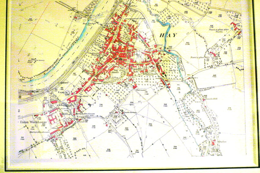
Herefordshire Sheet XXX 12 Brecknockshire XV11 12 Radnorshire XXXV1 12 Edition of 1929 Surveyed 1887 Revised 1927. Relevant topographic coverage – Hay and the Dingle to Ty Glyn
-
Herefordshire XXX1.3 Brecknockshire XV111 13 2nd Edition 1904. Surveyed 1886 Revised 1903. Relevant topographic coverage – Dyffryn, New Forest Farm, Cusop Hill
Scale 1:10,560 (6” to 1 mile)
-
Photo copy Brecknockshire XV111 SW Herefordshire XXX1 SW 2nd Edition 1905 Surveyed 1886 Revised 1903. Relevant topographic coverage – Eastwards from Cusop church
-
As above Surveyed 1886 but 1903 printing.
Scale 1:63,360 (1” to 1 Mile)
-
David & Charles reprint of 1st Edition 1828/29. Relevant topographic coverage – Includes Cusop, the old road pattern is interesting.
-
Facsimile of 1831. Relevant topographic coverage – Hay - Craswall
-
Hay Sheet 197 Surveyed 1884-87 Revised 1897 Railways added October 1903. Relevant topographic coverage – Kington south to part way up Dingle
-
Popular Edition Sheet 91 Abergavenny. Surveyed 1872-87 Revised 1890-94, 1904-08, 1913. Relevant topographic coverage – mid Dingle southwards, covers parish with Kington sheet.
-
Popular Edition Sheet 80 Kington. Surveyed 1883 Revised 1897, 1907/08, 1915/16. Relevant topographic coverage – Hay and northern half of parish, covers parish with sheet 91 above.
-
Sheets 80 and 91 2nd War Revision 1940. No revision dates, the 2 maps cover the parish.
Land Utilisation Map
-
Sheets 80 and 91 surveyed 1933-34 Relevant topographic coverage – 2 sheets cover the parish.
-
Facsimile of John Speed’s map of Herefordshire 1610. Unknown scale but about 1:200,000. Relevant topographic coverage – Too small a scale to be of real interest other than name Kewsop.

Cusop Tithe Map 1840. See Ewyas Lacy site for details of field number references.